Category:Stamford Bridge, East Riding of Yorkshire
Jump to navigation
Jump to search
English: Stamford Bridge is a village and civil parish on the River Derwent in the East Riding of Yorkshire, England, approximately 7 miles (11 km) east of York.
village and civil parish in the East Riding of Yorkshire, England, UK  | |||||
| Upload media | |||||
| Instance of | |||||
|---|---|---|---|---|---|
| Location | East Riding of Yorkshire, Yorkshire and the Humber, England | ||||
| Population |
| ||||
 | |||||
Subcategories
This category has the following 13 subcategories, out of 13 total.
Media in category "Stamford Bridge, East Riding of Yorkshire"
The following 73 files are in this category, out of 73 total.
-
 A Rural Road Junction - geograph.org.uk - 2498055.jpg 3,264 × 2,448; 2.13 MB
-
 Approaching Full Sutton - geograph.org.uk - 262290.jpg 640 × 480; 106 KB
-
 Approaching the Derwent - geograph.org.uk - 2930384.jpg 640 × 427; 447 KB
-
 Battle Flats - geograph.org.uk - 3763530.jpg 640 × 427; 86 KB
-
 Bay Horse pub at Stamford Bridge - geograph.org.uk - 3872172.jpg 1,600 × 1,200; 577 KB
-
 Brick arches of the viaduct - geograph.org.uk - 3107730.jpg 1,024 × 768; 368 KB
-
 Canal - Stamford Bridge - geograph.org.uk - 2529341.jpg 640 × 480; 132 KB
-
 Corn Mill Apartments, Stamford Bridge - geograph.org.uk - 3110619.jpg 760 × 1,024; 420 KB
-
 Crossing the footbridge, Stamford Bridge - geograph.org.uk - 3110604.jpg 800 × 581; 194 KB
-
 Derwent Dale - geograph.org.uk - 261041.jpg 640 × 425; 68 KB
-
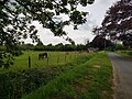 Donkeys beside Moor Lane - geograph.org.uk - 6165370.jpg 1,024 × 768; 768 KB
-
 Drainage ditch near Stamford Bridge - geograph.org.uk - 2371426.jpg 1,600 × 1,200; 570 KB
-
 East Riding of Yorkshire sign - geograph.org.uk - 3110607.jpg 1,024 × 768; 217 KB
-
 Fair Field, Stamford Bridge - geograph.org.uk - 5531110.jpg 800 × 600; 112 KB
-
 Farmland near High Burtonfields Farm - geograph.org.uk - 2371351.jpg 640 × 480; 76 KB
-
 Farmland under power lines off Moor Lane - geograph.org.uk - 2371446.jpg 1,600 × 1,200; 338 KB
-
 Footpath alongside River Derwent - geograph.org.uk - 2529351.jpg 640 × 480; 87 KB
-
 Footpath over a battlefield toward Stamford Bridge - geograph.org.uk - 4865205.jpg 4,608 × 3,456; 4.41 MB
-
 Footpath to Low Burtonfields Farm - geograph.org.uk - 399723.jpg 640 × 478; 109 KB
-

-
 Former Corn Mill, Stamford Bridge - geograph.org.uk - 3110623.jpg 768 × 1,024; 276 KB
-
 Former corn mill, Stamford Bridge - geograph.org.uk - 4299406.jpg 1,024 × 768; 202 KB
-
 Free range pigs near Full Sutton - geograph.org.uk - 2503765.jpg 800 × 600; 266 KB
-
 From the High Catton road - geograph.org.uk - 285031.jpg 640 × 479; 43 KB
-
 Health Centre, Stamford Bridge - geograph.org.uk - 3110591.jpg 1,024 × 768; 355 KB
-

-
 Methodist Church, Stamford Bridge - geograph.org.uk - 3110611.jpg 1,024 × 768; 258 KB
-
 Millsike Beck - geograph.org.uk - 2372040.jpg 1,600 × 1,200; 671 KB
-
 Millsike Beck - geograph.org.uk - 285148.jpg 640 × 479; 85 KB
-
 Millsike Beck - geograph.org.uk - 399243.jpg 640 × 478; 143 KB
-
 On the road to Stamford Bridge - geograph.org.uk - 60006.jpg 640 × 480; 94 KB
-
 Open Air Pigs - geograph.org.uk - 2498028.jpg 3,264 × 2,448; 1.47 MB
-
 Over field to Burtonfield Hall - geograph.org.uk - 4865216.jpg 4,608 × 3,456; 5.23 MB
-
 Pig farm off Moor Lane - geograph.org.uk - 2371451.jpg 1,600 × 1,200; 301 KB
-
 Pigs off Moor Lane - geograph.org.uk - 3678796.jpg 640 × 427; 71 KB
-
 Post Office, Stamford Bridge - geograph.org.uk - 3110632.jpg 1,024 × 768; 265 KB
-
 Pylons and Farmland - geograph.org.uk - 411476.jpg 640 × 355; 54 KB
-
 Railway viaduct at Stamford Bridge - geograph.org.uk - 3928571.jpg 1,600 × 1,200; 966 KB
-
 River Derwent - geograph.org.uk - 3767068.jpg 640 × 427; 70 KB
-
 River Derwent at Stamford Bridge - geograph.org.uk - 6085174.jpg 1,024 × 768; 271 KB
-
 River Derwent from Stamford Bridge - geograph.org.uk - 3745408.jpg 640 × 411; 60 KB
-
 River Derwent from the Viaduct - geograph.org.uk - 3867831.jpg 640 × 427; 80 KB
-
 Riverside footpath goes under railway viaduct - geograph.org.uk - 4881243.jpg 4,608 × 3,456; 4.31 MB
-
 Riverside path near Stamford Bridge - geograph.org.uk - 6214889.jpg 1,024 × 768; 178 KB
-
 Road bridge at Stamford Bridge - geograph.org.uk - 3520200.jpg 640 × 508; 192 KB
-
 St John the Baptist, Stamford Bridge - geograph.org.uk - 5531131.jpg 800 × 600; 130 KB
-
 St John the Baptist, Stamford Bridge - interior - geograph.org.uk - 5531134.jpg 1,024 × 768; 594 KB
-
 St John's Church, Stamford Bridge - geograph.org.uk - 3872186.jpg 1,600 × 1,200; 743 KB
-
 St. John the Baptist - geograph.org.uk - 6165371.jpg 1,024 × 768; 607 KB
-
 Stamford Bridge - East Riding of Yorkshire dot.png 417 × 599; 122 KB
-
 Stamford Bridge - geograph.org.uk - 2930358.jpg 640 × 427; 377 KB
-
 Stamford Bridge - geograph.org.uk - 3110598.jpg 1,024 × 768; 228 KB
-
 Stamford Bridge - geograph.org.uk - 6116938.jpg 2,048 × 1,536; 1.32 MB
-
 Stamford Bridge at dusk - geograph.org.uk - 2364236.jpg 640 × 480; 70 KB
-
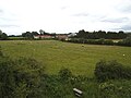
 Stamford Bridge Cricket Club - geograph.org.uk - 1824975.jpg 640 × 480; 110 KB
-
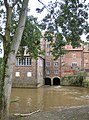
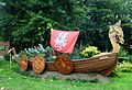 Stamford Bridge Longboat.jpg 876 × 598; 358 KB
-
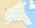 Stamford Bridge, East Riding of Yorkshire UK parish locator map.svg 1,425 × 1,107; 1.68 MB
-
 The A166 at Stamford Bridge - geograph.org.uk - 3525863.jpg 1,024 × 768; 257 KB
-
 The bridge over the River Derwent at Stamford Bridge - geograph.org.uk - 3872182.jpg 1,600 × 1,200; 805 KB
-

-
 The Minster Way - geograph.org.uk - 262294.jpg 640 × 480; 103 KB
-
 The New Inn, Stamford Bridge - geograph.org.uk - 3525856.jpg 1,024 × 768; 226 KB
-
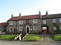
 The Square, Stamford Bridge - geograph.org.uk - 4297544.jpg 1,024 × 768; 136 KB
-
 The Stamford Bridge road - geograph.org.uk - 399245.jpg 640 × 478; 131 KB
-
 The Swordsman Inn - geograph.org.uk - 3132135.jpg 800 × 600; 224 KB
-
 The Track To Barley Cottage - geograph.org.uk - 260055.jpg 640 × 480; 109 KB
-

-
 This is Flat - geograph.org.uk - 2498046.jpg 640 × 480; 52 KB
-
 Track to High Burtonfields Farm - geograph.org.uk - 2371345.jpg 1,600 × 1,200; 348 KB
-
 Track to White House Farm - geograph.org.uk - 2371437.jpg 1,600 × 1,200; 378 KB
-
 Under transmission lines - geograph.org.uk - 399246.jpg 640 × 478; 184 KB
-
 Wildfowl in the shallows - geograph.org.uk - 3110629.jpg 1,024 × 768; 352 KB
-
 Winchmore - geograph.org.uk - 285136.jpg 640 × 479; 59 KB


